kopia lustrzana https://github.com/openmaptiles/openmaptiles
6
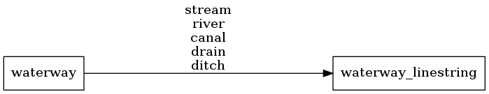
waterway
Lukas Martinelli edytuje tę stronę 2016-12-08 11:02:37 +00:00
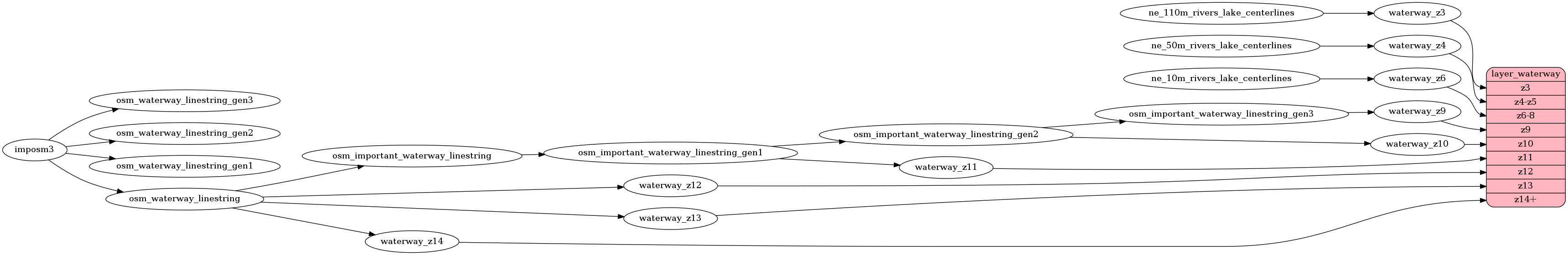
Rivers based of OpenStreetMap waterways for z9 to z14
and Natural Earth rivers and lake centerlines from z3 to z8.
Linestrings without a name or which are too short are filtered
out at low zoom levels. Waterways do no not have a subclass field.
Fields
name
The OSM name value of the waterway.
The name field is empty for NaturalEarth data until z9 when OSM data is used.
class
The original value of the waterway tag.
Can be one of stream,
river,
canal,
drain,
ditch`.
Mapping Diagram
ETL Diagram
SQL
SELECT geometry, name, class FROM layer_waterway(ST_SetSRID('BOX3D(-20037508.34 -20037508.34, 20037508.34 20037508.34)'::box3d, 3857 ), 14)