kopia lustrzana https://github.com/openmaptiles/openmaptiles
5
aeroway
Lukas Martinelli edytuje tę stronę 2016-12-08 11:02:37 +00:00
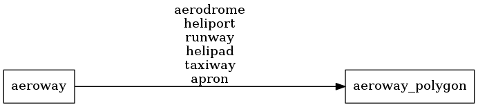
Aeroway polygons based of OpenStreetMap aeroways. Airport buildings are contained in the building layer but all other airport related polygons can be found in the aeroway layer.
Fields
class
The original value of the aeroway tag.
Possible values:
aerodromeheliportrunwayhelipadtaxiwayapron
Mapping Diagram
ETL Diagram
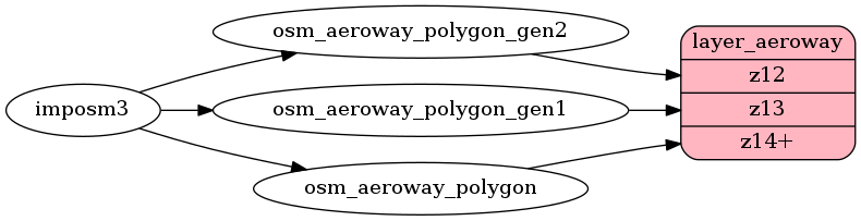
SQL
SELECT geometry, class FROM layer_aeroway(ST_SetSRID('BOX3D(-20037508.34 -20037508.34, 20037508.34 20037508.34)'::box3d, 3857 ), 14)