kopia lustrzana https://github.com/openmaptiles/openmaptiles
7
boundary
Lukas Martinelli edytuje tę stronę 2016-12-08 11:02:37 +00:00
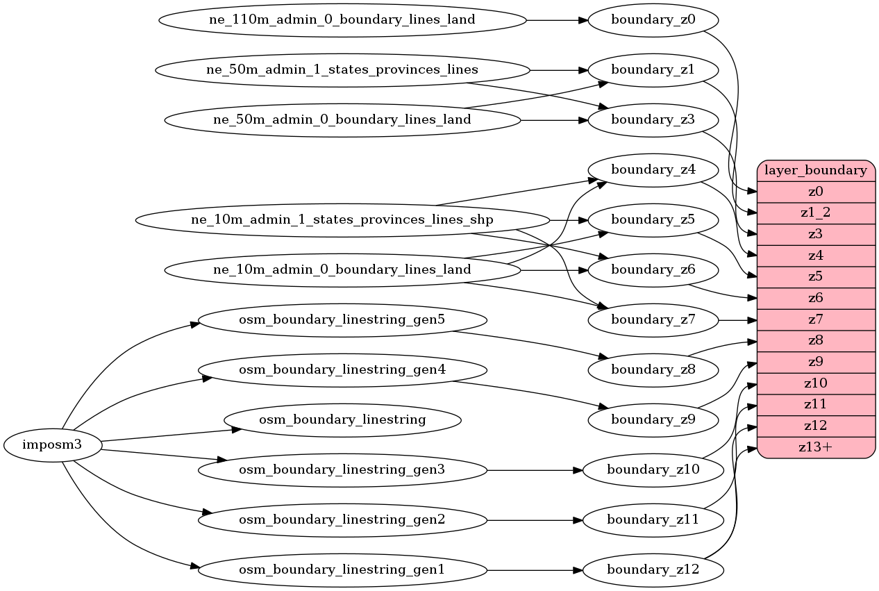
Contains administrative boundaries as linestrings (no maritime boundaries yet) as linestrings.
Until z7 Natural Earth data
is used after which OSM boundaries (boundary=administrative) are present from z8 to z14.
OSM data contains all admin_level
but for most styles it makes sense to just style admin_level=2 and admin_level=4.
Fields
admin_level
OSM admin_level
indicating the level of importance of this boundary.
The admin_level corresponds to the lowest admin_level
the line participates in.
At low zoom levels the Natural Earth boundaries are mapped to the equivalent admin levels.
disputed
Mark with 1 if the boundary is disputed.
Possible values:
01
Mapping Diagram

ETL Diagram
SQL
SELECT geometry, admin_level FROM layer_boundary(ST_SetSRID('BOX3D(-20037508.34 -20037508.34, 20037508.34 20037508.34)'::box3d, 3857 ), 14)