kopia lustrzana https://github.com/openmaptiles/openmaptiles
6
landcover
Lukas Martinelli edytuje tę stronę 2016-12-08 11:02:37 +00:00
Landcover is used to describe the physical material at the surface of the earth. At lower zoom levels this is
from Natural Earth data for glaciers and ice shelves and at higher zoom levels the [landcover is implied by OSM tags. The most common use case for this layer
is to style wood (class=wood) and grass (class=grass`) areas.
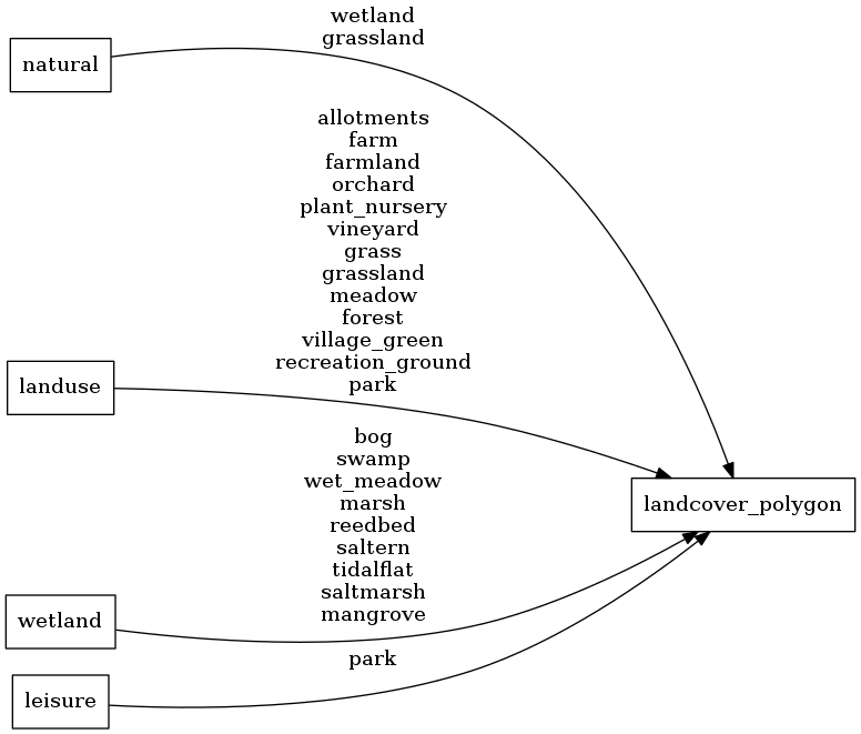
Fields
class
Use the class to assign natural colors for landcover.
Possible values:
farmlandicewoodgrasswetland
subclass
Use subclass to do more precise styling.
Original value of either the
natural,
landuse,
,leisure,
or wetland tag.
Possible values:
allotmentsfarmfarmlandorchardplant_nurseryvineyardgrassgrasslandmeadowforestvillage_greenrecreation_groundparkwetlandgrasslandbogswampwet_meadowmarshreedbedsalterntidalflatsaltmarshmangrove
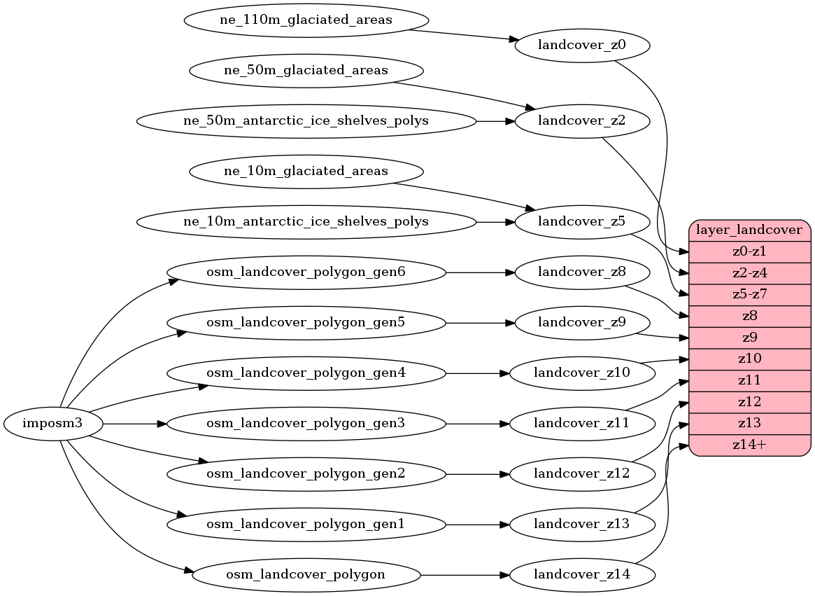
Mapping Diagram
ETL Diagram
SQL
SELECT geometry, class, subclass FROM layer_landcover(ST_SetSRID('BOX3D(-20037508.34 -20037508.34, 20037508.34 20037508.34)'::box3d, 3857 ), 14)