The place layer consists out of countries, states and cities. Apart from the roads this is also one of the more important layers to create a beautiful map. We suggest you use different font styles and sizes to create a text hierarchy.
Fields
name_en
The English name:en value or local name if not available.
capital
The capital field marks the
admin_level
of the boundary the place is a capital of.
Possible values:
24
class
description: |
Original value of the
place tag.
Distinguish between continents, countries, states and
places like settlements or smaller entities.
Use class to separately style the different places and build
a text hierarchy according to their importance.
values:
- continent
- country
- state
- city
- town
- village
- hamlet
- suburb
- neighbourhood
- isolated_dwelling
rank
Countries, states and the most important cities all have a
rank to boost their importance on the map.
The rank field for counries and states ranges from
1 to 6 while the rank field for cities ranges from
1 to 10 for the most important cities
and continues from 10 serially based on the
local importance of the city (derived from population and city class).
You can use the rank to limit density of labels or improve
the text hierarchy.
The rank value is a combination of the Natural Earth
scalerank, labelrank and datarank values for countries
and states and for cities consists out of a shifted
Natural Earth scalerank combined with a local rank
within a grid for cities that do not have a Natural Earth scalerank.
name
The OSM name value of the POI.
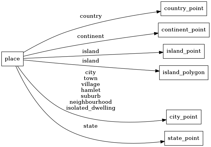
Mapping Diagram
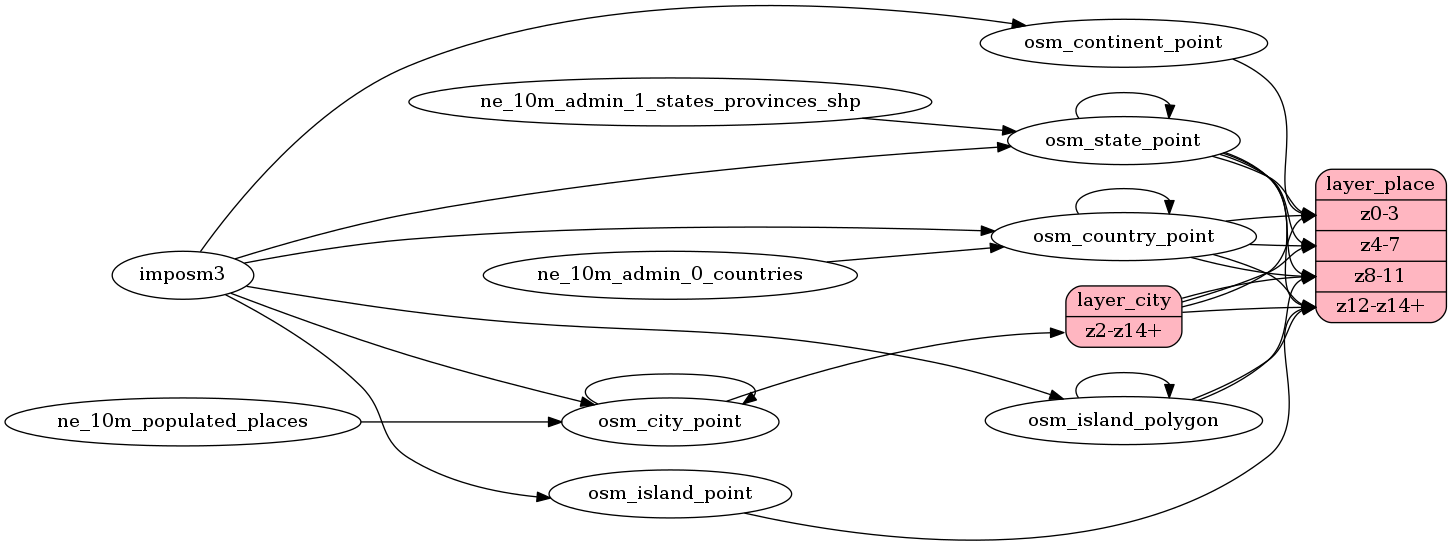
ETL Diagram
SQL
SELECT geometry, name, name_en, class, rank, capital FROM layer_place(ST_SetSRID('BOX3D(-20037508.34 -20037508.34, 20037508.34 20037508.34)'::box3d, 3857 ), 14, 1)