kopia lustrzana https://github.com/openmaptiles/openmaptiles
6
landuse
Lukas Martinelli edytuje tę stronę 2016-12-08 11:02:37 +00:00
Landuse is used to describe use of land by humans.At lower zoom levels this is
from Natural Earth data for residential (urban) areas and at higher zoom levels mostly OSM landuse tags.
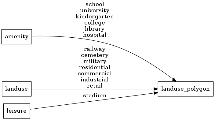
Fields
class
Use the class to assign special colors to areas.
Original value of either the
amenity,
landuse,
or leisure tag.
Possible values:
schooluniversitykindergartencollegelibraryhospitalrailwaycemeterymilitaryresidentialcommercialindustrialretailstadium
Mapping Diagram
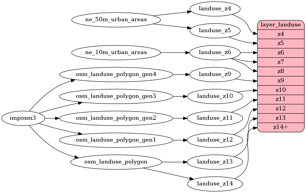
ETL Diagram
SQL
SELECT geometry, class FROM layer_landuse(ST_SetSRID('BOX3D(-20037508.34 -20037508.34, 20037508.34 20037508.34)'::box3d, 3857 ), 14)