|
|
||
|---|---|---|
| decoder | ||
| tracker | ||
| .gitignore | ||
| LICENCE.md | ||
| README.md | ||
| airport_tempelhof.jpg | ||
| cloudy_germany.jpg | ||
| lakes_west_poland.jpg | ||
| low_altitude.jpg | ||
| powering.md | ||
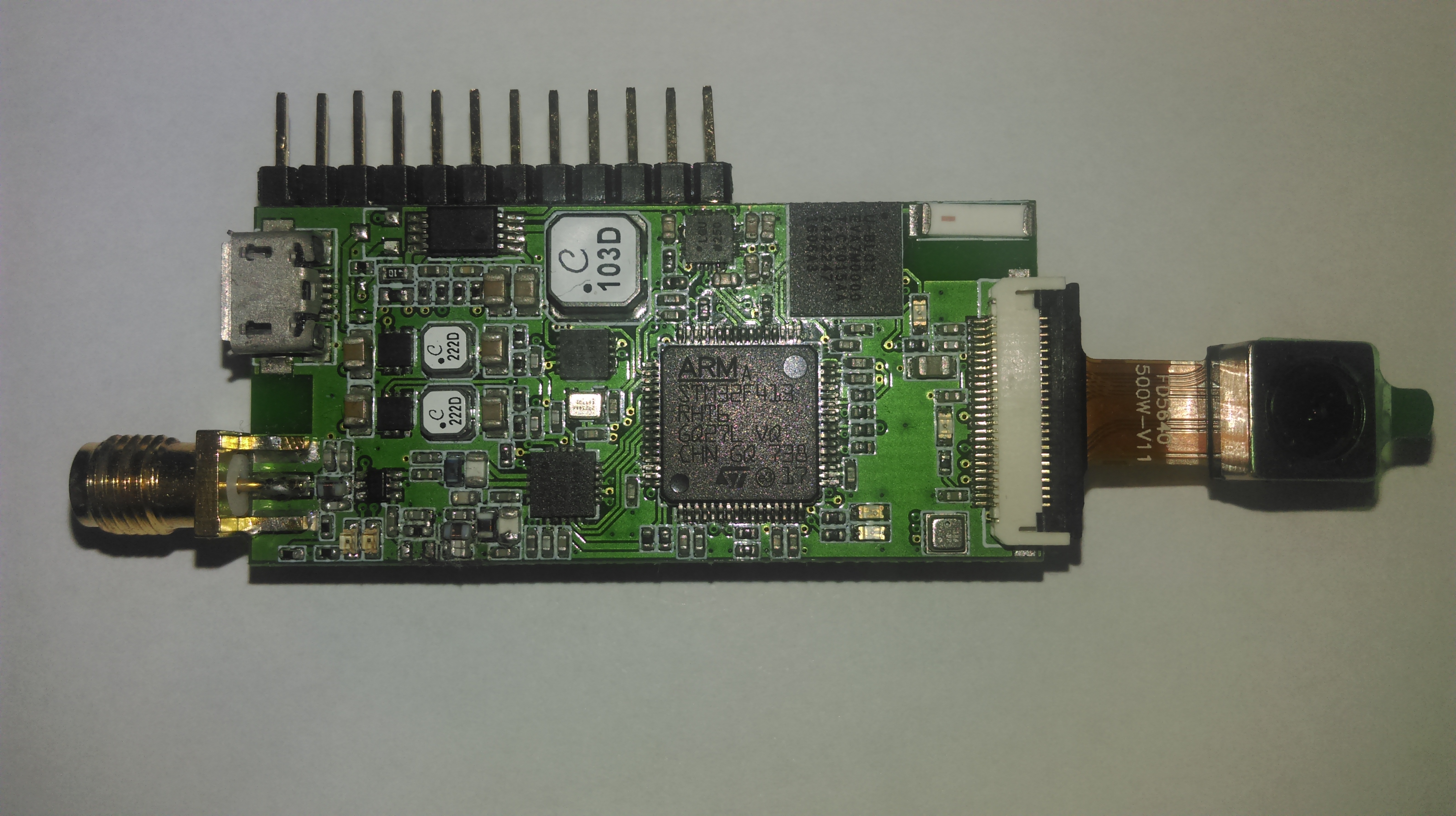
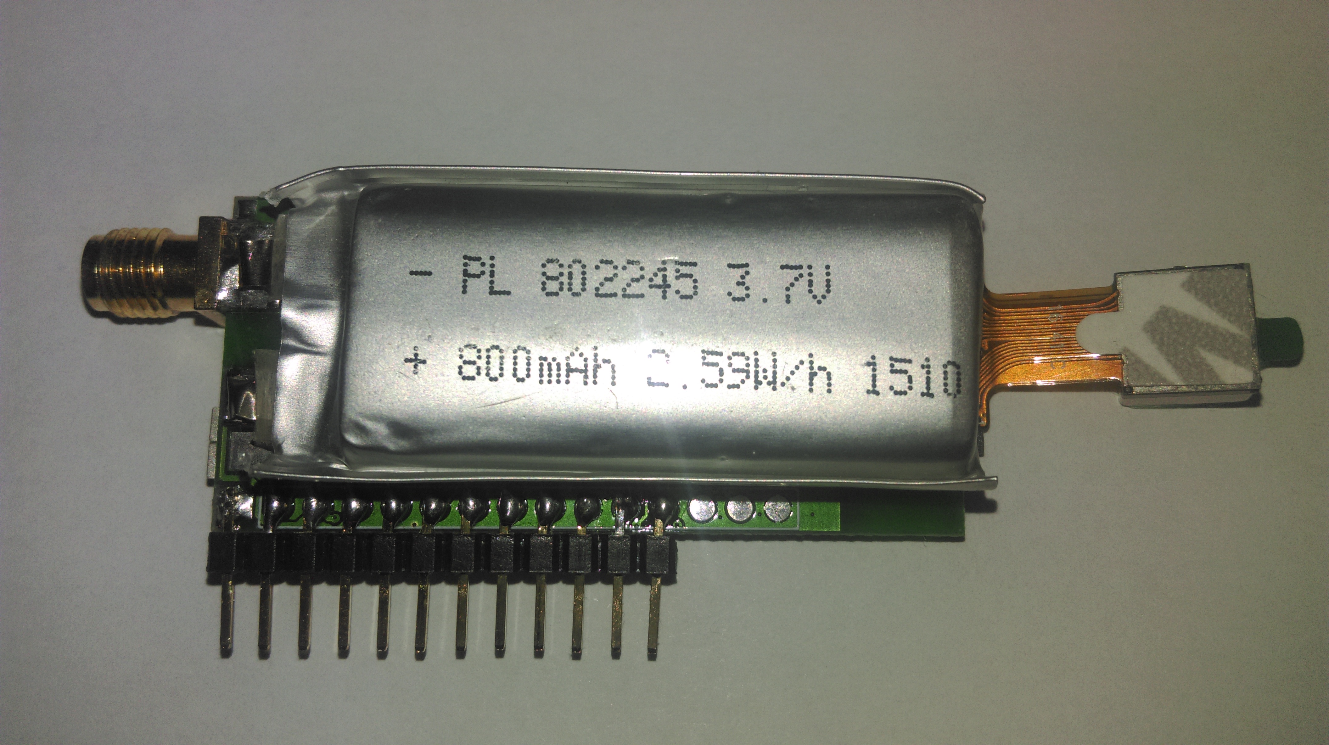
| pp10_back.jpg | ||
| pp10_front.jpg | ||
| pp10a_kicad.png | ||
| solar_balloon.jpg | ||
| south_east_berlin.jpg | ||
README.md
Pecan Pico 10 - A lightweight APRS tracker and digipeater
This project contains the Pecan Pico project in it's 10th version. A Pecan is a cheap lightweight APRS position tracker designed especially for small ballons which may fly for months. This tracker has been made in respect of weight, functionality and price because it's usually used once like a satellite. While the balloon can fly for a long time, this tracker is solar powered and recharges it's battery at daytime and uses the power stored in the battery at night. Since this version the tracker is also able to receive APRS (AFSK and FSK). So it's able to operate as solar enabled digipeater.
The main features are:
- GPS Tracking
- Taking pictures
- APRS receiption and transmission
- Measuring Temperature/Airpressure/Humidity (up to 3 separate sensors)
- Digipeating
Powering: The Pecan Pico 10 can be powered either by USB or by a single LiPO cell which are charged with solar cells. In power safe mode, it uses 50mW and around 150-200mW in normal operation. dive deeper
Storage: There can be stored up to 14,560 data points (GPS & telemetry) without any external memory devices. For additional storage and picture logging, a Micro SD card can be inserted into the device.
Transceiver: Though the software is mainly optimized for APRS operation, it can be also used for 2/4FSK (RTTY) and OOK (CW) operation. The maximum transmission power is 100mW. While the transceiver has ony a signle LPF, it is only able to operate on one frequency band (either 2m or 70cm). The inductors/capacitors in the schematic are adjusted to the 2m amateur radio band, but with different components it can be used on the 70cm band too. The fastest tested 2FSK transmission speed is 115k2. While the Pecan can transmit AFSK and 2FSK, it is only able to receive AFSK APRS. It is possible to receive 2FSK APRS too, although the software hasn't been implemented yet.
Image transmission: The software makes use of the JPEG compression of the Omnivision OV5640. Although the connector is suitable for some other cameras too, the OV5640 is the only camera which can be used due to the missing HREF pin. The protocol being used for the images transmission is APRS/SSDV. This protocol is fully APRS compatible but needs extra software to be decoded again which is included in this project. Though the camera can do pictures up to 5MP, there is only enough memory available to take XGA pictures (1024x768px). TODO: Precise description about APRS/SSDV
Telemetry transmission: Since APRS does only allow a ceirtain amount of telemetry fields being transmitted, the complete telemetry is sent as a binary format along with the position transmissions in the comment field. The APRS packet stays completly compatible with the existing network. The additional telemetry can be decoded with an additional decoder which is included in this project. It is the same decoder which decodes APRS/SSDV too. The software is currently running on this website.
Sensors: The Pecan uses a single chip (BME280) to measure the temperature, airpressure and humidity. There can be attached up to two additional BME280's for various purposes like internal and external temperatures. You may want to have an external sensor while the internal sensor on the PCB is influenced by the heat generated by the components. The difference can vary between 2 and 10°C.
Additional sensors: The Pecan provides an external busses (I2C and UART) from where addional sensors can be accessed. On the 10a variant is a signle GPIO pin, which can be used for varios stuff. There can either be I2C or UART be used on the 10a variant while I2C shared the same pins as UART does. In the 10b variant the additional GPIO pin has been removed, therefore I2C and UART are now separate. If you have no need for UART/I2C, those pins can be also used as normal GPIO's.
GNSS (GPS): The ublox EVA-7M chip can receive GPS which is used to determine it's location and the region specific APRS frequency. Since the GPS draws a lot of power, it can be switched on and off as needed. The device is also compatible with the ublox EVA-M8 which can receive GLONASS, Beido and Galileo too.
Debugging/Configuration: The device can be accessed over USB (serial terminal) in order to configure it or get debug messages out of the device. The log memory can also be accessed over USB.
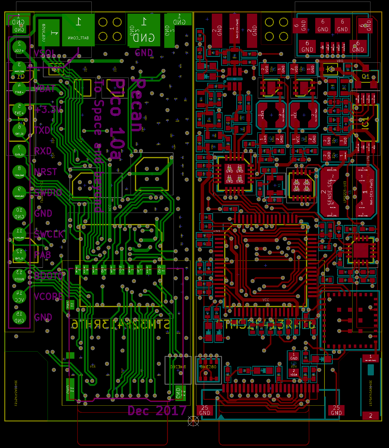
Schematic: Here we go! Download
Operation variants
- Car/Balloon Tracker
- Digipeater
- Weather station (software not implemented yet)
- Image transmitting device All variants can be combined with each other
Software Manual TODO: How to access it through USB TODO: How to configure the device
More: Flashing the chip (link missing)
Transmitted test pictures
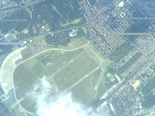
Closed Airport Berlin Tempelhof roughly 3km altitude
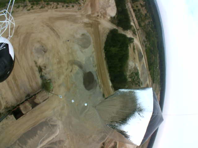
Picture at low altitude right away after the launch

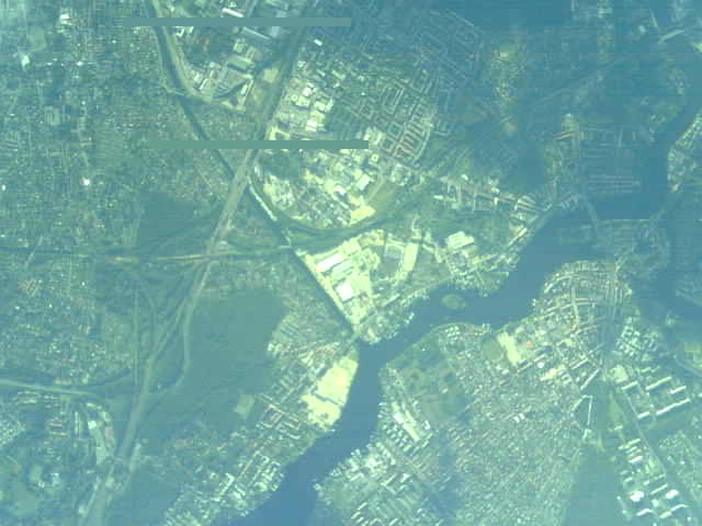
Clouds somewhere in Germany at an altitude of 12km
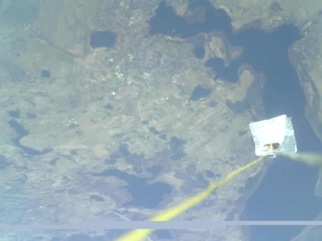
Lakes in East Poland (Myślibórz) at 8km altitude, antenna and radar reflector in the picture
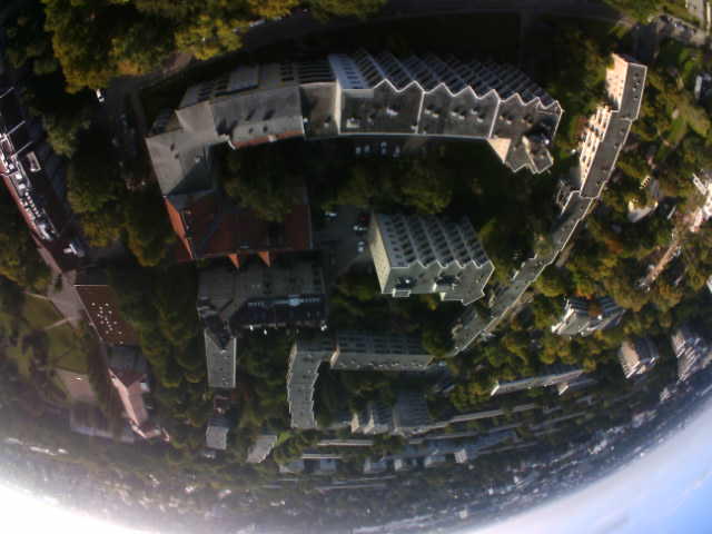
South East Berlin (Adlershof/Grünau) taken at roughly 5km altitude
Launch with solar heated balloons (a cooperation with Aerocene)
Contributions
Please let me know if you have questions or ideas: sven.steudte@gmail.com