kopia lustrzana https://github.com/openmaptiles/openmaptiles
#1313 added `expressway` tagging to the transportation layer. However, this also added the `expressway` attributes to ramps where it doesn't make sense (ramps by definition are controlled-access roads in all cases). This PR corrects this by dropping the `expressway` attribute from ramps where it doesn't make sense to do so. See also ZeLonewolf/openstreetmap-americana#1017 |
||
|---|---|---|
| .. | ||
| README.md | ||
| class.sql | ||
| etl_diagram.png | ||
| highway_name.sql | ||
| mapping.yaml | ||
| mapping_diagram.png | ||
| network_type.sql | ||
| style.json | ||
| transportation.sql | ||
| transportation.yaml | ||
| update_route_member.sql | ||
| update_transportation_merge.sql | ||
README.md
transportation
Docs
Read the layer documentation at http://openmaptiles.org/schema#transportation
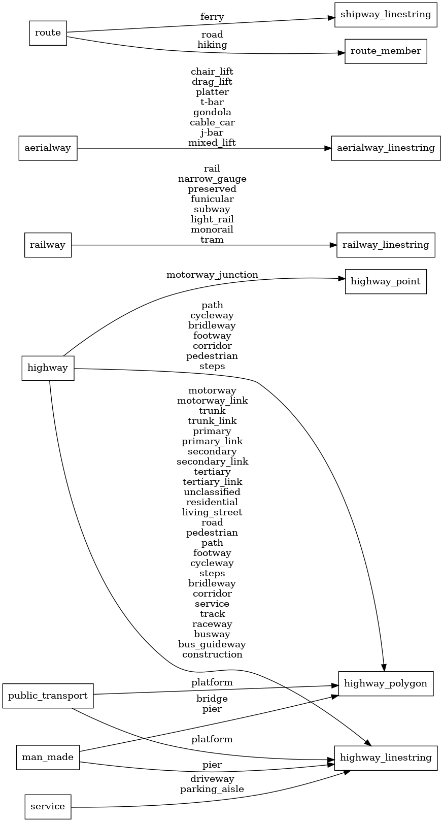
Mapping Diagram
ETL diagram
