|
|
||
|---|---|---|
| app | ||
| db | ||
| nodeodm | ||
| screenshots | ||
| slate | ||
| webodm | ||
| .gitignore | ||
| .gitmodules | ||
| .travis.yml | ||
| CONDUCT.md | ||
| CONTRIBUTING.md | ||
| Dockerfile | ||
| LICENSE.md | ||
| README.md | ||
| docker-compose.nodeodm.yml | ||
| docker-compose.yml | ||
| manage.py | ||
| package.json | ||
| requirements.txt | ||
| start.sh | ||
| wait-for-it.sh | ||
| webodm.sh | ||
| webpack-server.js | ||
| webpack.config.js | ||
README.md
WebODM

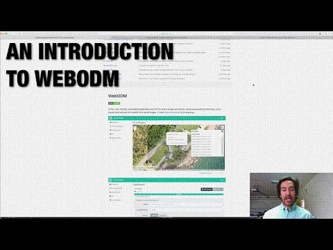
A free, user-friendly, extendable application and API for drone image processing. Generate georeferenced maps, point clouds and textured 3D models from aerial images. It uses OpenDroneMap for processing.


If you know Python, web technologies (JS, HTML, CSS, etc.) or both, make a fork, contribute something that interests you, and make a pull request! All ideas are considered and people of all skill levels are welcome. See the Contributing document for more information.
Getting Started
- Install the following applications (if they are not installed already):
- From the Docker Quickstart Terminal (Windows) or from the command line (Mac / Linux) type:
git clone https://github.com/OpenDroneMap/WebODM --config core.autocrlf=input
cd WebODM
./webodm.sh start
- If you're on Windows find the IP of your Docker machine by running this command from your Docker Quickstart Terminal:
docker-machine ip
Linux / Mac, users can connect to 127.0.0.1.
- Open a Web Browser to
http://<yourDockerMachineIp>:8000 - Log in with the default credentials: "admin:admin"
To stop WebODM press CTRL+C or run:
./webodm.sh stop
To update WebODM to the latest version use:
./webodm.sh update
We recommend that you read the Docker Documentation to familiarize with the application lifecycle, setup and teardown, or for more advanced uses. Look at the contents of the webodm.sh script to understand what commands are used to launch WebODM.
Common Troubleshooting
if you get the following error while starting WebODM:
from six.moves import _thread as thread
ImportError: cannot import name _thread
Try running:
sudo pip install --ignore-installed six
If you are getting a MemoryError while processing the images, make sure that your Docker environment has enough RAM allocated. http://stackoverflow.com/a/39720010
If you are getting a django.contrib.auth.models.DoesNotExist: Permission matching query does not exist. after an update, try to remove your WebODM folder and start from a fresh git clone.
Have you had other issues? Please report them so that we can include them in this document.
Add More Processing Nodes
WebODM can be linked to one or more processing nodes running node-OpenDroneMap. The default configuration already includes a "node-odm-1" processing node which runs on the same machine as WebODM, just to help you get started. As you become more familiar with WebODM, you might want to install processing nodes on separate machines.
Run it natively
If you want to run WebODM natively, you will need to install:
- PostgreSQL (>= 9.5)
- PostGIS 2.3
- Python 3.5
- GDAL (>= 2.1)
- Node.js (>= 6.0)
On Linux, make sure you have:
apt-get install binutils libproj-dev gdal-bin
On Windows use the OSGeo4W installer to install GDAL. MacOS users can use:
brew install postgres postgis
Then these steps should be sufficient to get you up and running:
git clone https://github.com/OpenDroneMap/WebODM
Create a WebODM\webodm\local_settings.py file containing your database settings:
DATABASES = {
    'default': {
        'ENGINE': 'django.contrib.gis.db.backends.postgis',
        'NAME': 'webodm_dev',
        'USER': 'postgres',
        'PASSWORD': 'postgres',
        'HOST': 'localhost',
        'PORT': '5432',
    }
}
From psql or pgadmin, connect to the database and set the postgis.enable_outdb_rasters and postgis.gdal_enabled_drivers settings:
ALTER SYSTEM SET postgis.enable_outdb_rasters TO True;
ALTER SYSTEM SET postgis.gdal_enabled_drivers TO 'GTiff';
Then:
pip install -r requirements.txt
sudo npm install -g webpack
npm install
webpack
chmod +x start.sh && ./start.sh
If you are getting a rt_raster_gdal_warp: Could not create GDAL transformation object for output dataset creation, make sure that your PostGIS installation has PROJ support:
SELECT PostGIS_Full_Version();
You may also need to set the environment variable PROJSO to the .so or .dll projection library your PostGIS is using. This just needs to have the name of the file. So for example on Windows, you would in Control Panel -> System -> Environment Variables add a system variable called PROJSO and set it to libproj.dll (if you are using proj 4.6.1). You'll have to restart your PostgreSQL service/daemon after this change. http://postgis.net/docs/manual-2.0/RT_ST_Transform.html
If you are using Windows and are unable to go past the pip install -r requirements.txt command because of an error regarding zlib and Pillow, manually edit the requirements.txt file, remove the Pillow requirement and run:
easy_install pillow
pip install -r requirements.txt
On Windows make sure that all of your PATH environment variables are set properly. These commands:
python --version
pip --version
npm --version
gdalinfo --version
Should all work without errors.
Roadmap
- User Registration / Authentication
- UI mockup
- Task Processing
- 2D Map Display
- 3D Model Display
- Volumetric Measurements
- Cluster management and setup.
- Mission Planner
- API
- Documentation
- Android Mobile App
- iOS Mobile App
- Processing Nodes Volunteer Network
- Unit Testing
Don't see a feature that you want? Help us make it happen.
Terminology
Project: A collection of tasks (successfully processed, failed, waiting to be executed, etc.)Task: A collection of input aerial images and an optional set of output results derived from the images, including an orthophoto, a georeferenced model and a textured model. ATask's output is processed by OpenDroneMap.ProcessingNode: An instance usually running on a separate VM, or on a separate machine which accepts aerial images, runs OpenDroneMap and returns the processed results (orthophoto, georeferenced model, etc.). Each node communicates with WebODM via a lightweight API such as node-OpenDroneMap. WebODM manages the distribution ofTaskto differentProcessingNodeinstances.ImageUpload: aerial images.Mission: A flight path and other information (overlap %, angle, ...) associated with a particularTask.