openmaptiles/layers/place
Tomas Pohanka fadc4a3ba6
Explicit mention for using `iso_a2` attribute. (#1073)
Resolve #939
2021-03-16 11:21:25 +01:00
..
README.md Update diagrams 2017-12-04 12:06:28 +01:00
capital.sql NOOP: Format all layer's SQL code (#917) 2020-06-08 12:19:55 -04:00
city.sql Remove alignment of AS in SQL and few others (#932) 2020-07-22 13:48:25 +02:00
etl_diagram.png Updated etl diagrams from latest tools 2020-02-14 16:22:48 -05:00
island_rank.sql NOOP: Format all layer's SQL code (#917) 2020-06-08 12:19:55 -04:00
mapping.yaml Add place=quarter to city subdivisions (#1065) 2021-01-18 14:47:25 +01:00
mapping_diagram.png Add place=quarter to city subdivisions (#1065) 2021-01-18 14:47:25 +01:00
place.sql Rename generic layer.sql to actual_layer_name .sql (#1034) 2020-11-09 11:43:35 +02:00
place.yaml Explicit mention for using `iso_a2` attribute. (#1073) 2021-03-16 11:21:25 +01:00
types.sql Add place=quarter to city subdivisions (#1065) 2021-01-18 14:47:25 +01:00
update_city_point.sql Add timers to trigger function (#1006) 2020-10-08 16:57:16 +03:00
update_continent_point.sql Add timers to trigger function (#1006) 2020-10-08 16:57:16 +03:00
update_country_point.sql Add timers to trigger function (#1006) 2020-10-08 16:57:16 +03:00
update_island_point.sql Add timers to trigger function (#1006) 2020-10-08 16:57:16 +03:00
update_island_polygon.sql add ST_IsValid where ST_PointOnSurface (#1025) 2020-10-13 16:28:20 +03:00
update_state_point.sql Add timers to trigger function (#1006) 2020-10-08 16:57:16 +03:00

README.md

place

Docs

Read the layer documentation at http://openmaptiles.org/schema#place
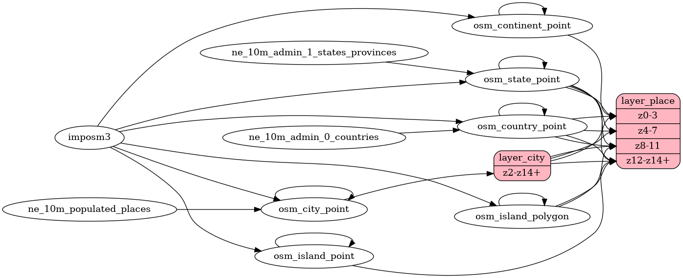
Mapping Diagram

Mapping diagram for place

ETL diagram

ETL diagram for place