openmaptiles/layers/place
Eva J 90c4854184 removing webmerc_area 2019-11-19 16:36:00 +01:00
..
README.md Update diagrams 2017-12-04 12:06:28 +01:00
capital.sql Switch place class back to place value 2016-12-02 12:30:41 +00:00
city.sql Wrap place UNIONs into one SELECT to sppeed up rendering 2018-11-30 15:32:26 +01:00
etl_diagram.png Refreshed all diagrams, fixed automation & 2 broken graphs (#692) 2019-10-26 21:28:43 -04:00
island_rank.sql Show islands #68 2016-12-02 14:37:48 +00:00
layer.sql Wrap place UNIONs into one SELECT to sppeed up rendering 2018-11-30 15:32:26 +01:00
mapping.yaml removing webmerc_area 2019-11-19 16:36:00 +01:00
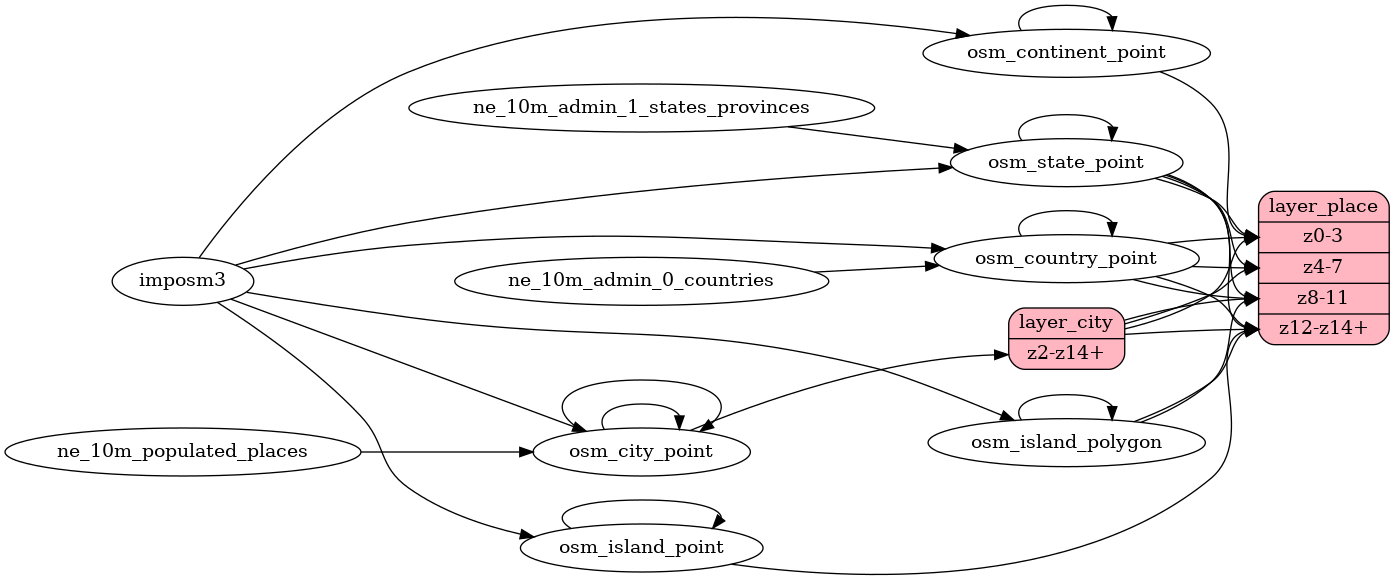
mapping_diagram.png Refreshed all diagrams, fixed automation & 2 broken graphs (#692) 2019-10-26 21:28:43 -04:00
place.yaml Add osm_id as key of places 2017-12-04 10:53:26 +01:00
types.sql Use classes from ClearTables and add continents 2016-11-28 15:43:03 +00:00
update_city_point.sql Fix missing cities with diacritics at Z6 2017-12-04 11:02:04 +01:00
update_continent_point.sql Import additional names from Wikidata 2017-11-16 09:03:41 +01:00
update_country_point.sql Revert back to NE 4.0.0 2018-11-30 15:32:26 +01:00
update_island_point.sql Import additional names from Wikidata 2017-11-16 09:03:41 +01:00
update_island_polygon.sql Import additional names from Wikidata 2017-11-16 09:03:41 +01:00
update_state_point.sql update the layers from natural earth latest data 2017-11-17 13:55:02 +01:00

README.md

place

Docs

Read the layer documentation at http://openmaptiles.org/schema#place

Mapping Diagram

Mapping diagram for place

ETL diagram

ETL diagram for place