kopia lustrzana https://github.com/openmaptiles/openmaptiles
In some areas of the world, ship transportation is the main means of long-distance travel. For example, in Alaska, the [Alaska Marine Highway System](https://dot.alaska.gov/amhs/route.shtml) is the principal means of transportation through the Alaska Panhandle and down the Aleutian island chain. The AMHS carries the same importance that the Interstate Highway System has on land, and these ferry routes are exceptionally long distance. |
||
|---|---|---|
| .. | ||
| README.md | ||
| etl_diagram.png | ||
| highway_classification.sql | ||
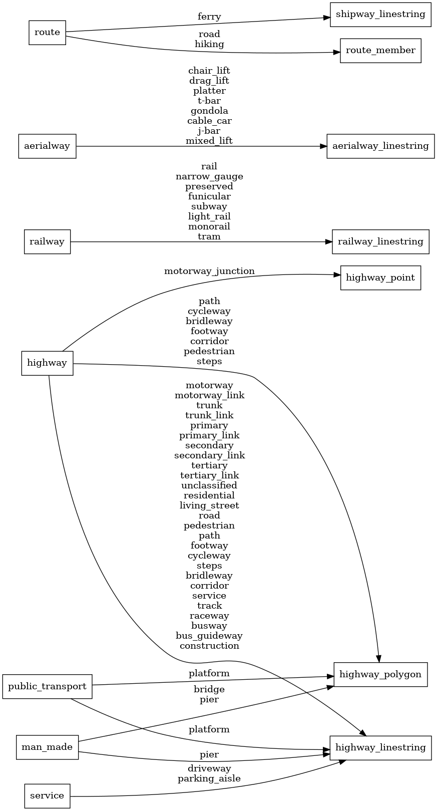
| mapping_diagram.png | ||
| style.json | ||
| transportation_name.sql | ||
| transportation_name.yaml | ||
| update_transportation_name.sql | ||
README.md
transportation_name
Docs
Read the layer documentation at http://openmaptiles.org/schema#transportation_name
Mapping Diagram
ETL diagram
