kopia lustrzana https://github.com/openmaptiles/openmaptiles
This PR fixes boundary layer at low zoom levels: -z4 - remove maritime boundary (Peru, northern and southern end of boundary between Canada and Alaska). -z1-z4 - do not mix disputed boundary from NE and OSM - linestrings got duplicated. Use only NE data (z0-z4), then OSM data (z5+) |
||
|---|---|---|
| .. | ||
| README.md | ||
| boundary.sql | ||
| boundary.yaml | ||
| boundary_name.sql | ||
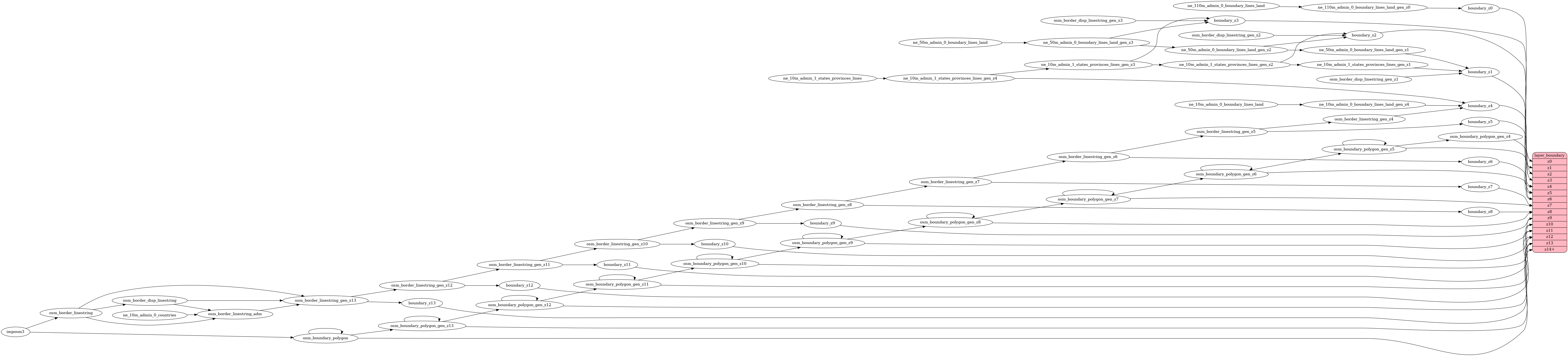
| etl_diagram.png | ||
| mapping.yaml | ||
| mapping_diagram.png | ||
| style.json | ||
| update_boundary_polygon.sql | ||