kopia lustrzana https://github.com/openmaptiles/openmaptiles
This PR addresses that by: * rendering oneway arrows on more than `subclass=cycleway` * less opacity for path/footway casing * adding the thin black casing to bridges * adding `subclass=steps` & `subclass=bridleway` rendering * render `bicycle=designated` as `subclass=cycleway` and `horse=designated` as `subclass=bridleway` (bike taking priority) * improved tunnel rendering with double casing & adding main line * made casing min zoom consistent across subclasses All of these changes were made to mimic OSM Carto. |
||
|---|---|---|
| .. | ||
| README.md | ||
| etl_diagram.png | ||
| mapping.yaml | ||
| mapping_diagram.png | ||
| style.json | ||
| update_marine_point.sql | ||
| update_water_lakeline.sql | ||
| update_water_point.sql | ||
| water_name.sql | ||
| water_name.yaml | ||
README.md
water_name
Docs
Read the layer documentation at http://openmaptiles.org/schema#water_name
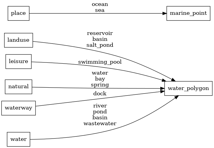
Mapping Diagram
ETL diagram
