kopia lustrzana https://github.com/openmaptiles/openmaptiles
Drop the main table for layer `transportation_name` layer before creation. For the first SQL import, it is OK, but for the second import (e.g. for a different country by `import-osm area=yyy`) without dropping the whole database it will keep `osm_transportation_name_network` filled with data from the first import (after first `import-sql` step) This PR will drop the already-filled table from the first import and insert data from the reimported area. |
||
|---|---|---|
| .. | ||
| README.md | ||
| class.sql | ||
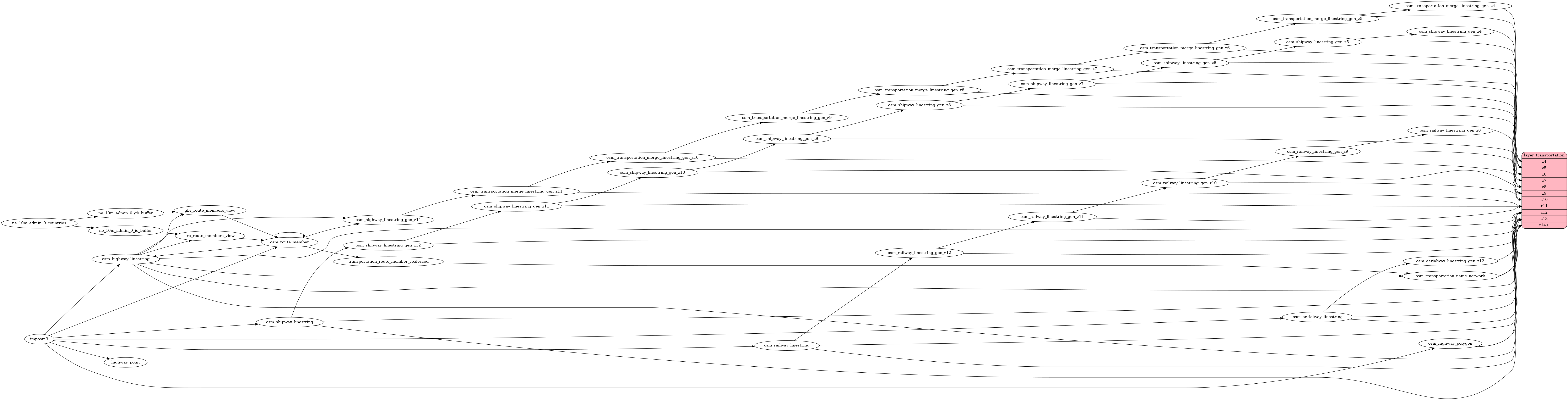
| etl_diagram.png | ||
| highway_name.sql | ||
| mapping.yaml | ||
| mapping_diagram.png | ||
| network_type.sql | ||
| style.json | ||
| transportation.sql | ||
| transportation.yaml | ||
| update_route_member.sql | ||
| update_transportation_merge.sql | ||
README.md
transportation
Docs
Read the layer documentation at http://openmaptiles.org/schema#transportation
Mapping Diagram

ETL diagram