kopia lustrzana https://github.com/openmaptiles/openmaptiles
This PR replaces the `route_N` attribute scheme with individual attributes for name and colour on routes. Thus you will have: * `route_N_network` to hold the route `network` value * `route_N_ref` to hold the route `ref` value * `route_N_name` to hold the route `name` value * `route_N_colour` to hold the route `colour` or `ref:colour` value |
||
|---|---|---|
| .. | ||
| README.md | ||
| class.sql | ||
| etl_diagram.png | ||
| highway_name.sql | ||
| mapping.yaml | ||
| mapping_diagram.png | ||
| network_type.sql | ||
| style.json | ||
| transportation.sql | ||
| transportation.yaml | ||
| update_route_member.sql | ||
| update_transportation_merge.sql | ||
README.md
transportation
Docs
Read the layer documentation at http://openmaptiles.org/schema#transportation
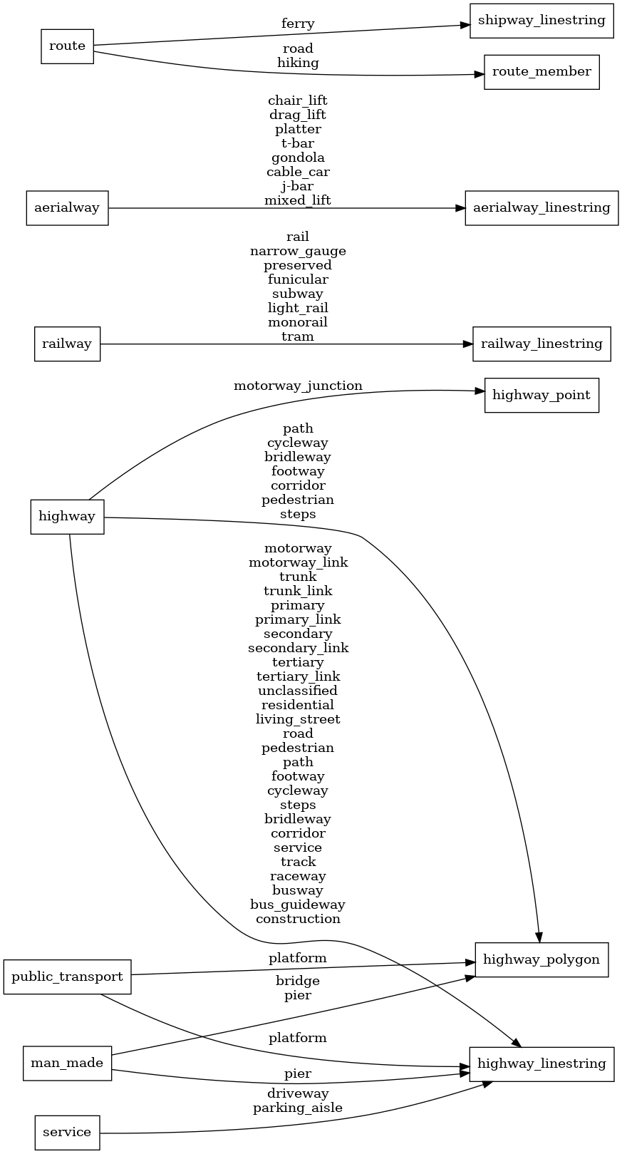
Mapping Diagram
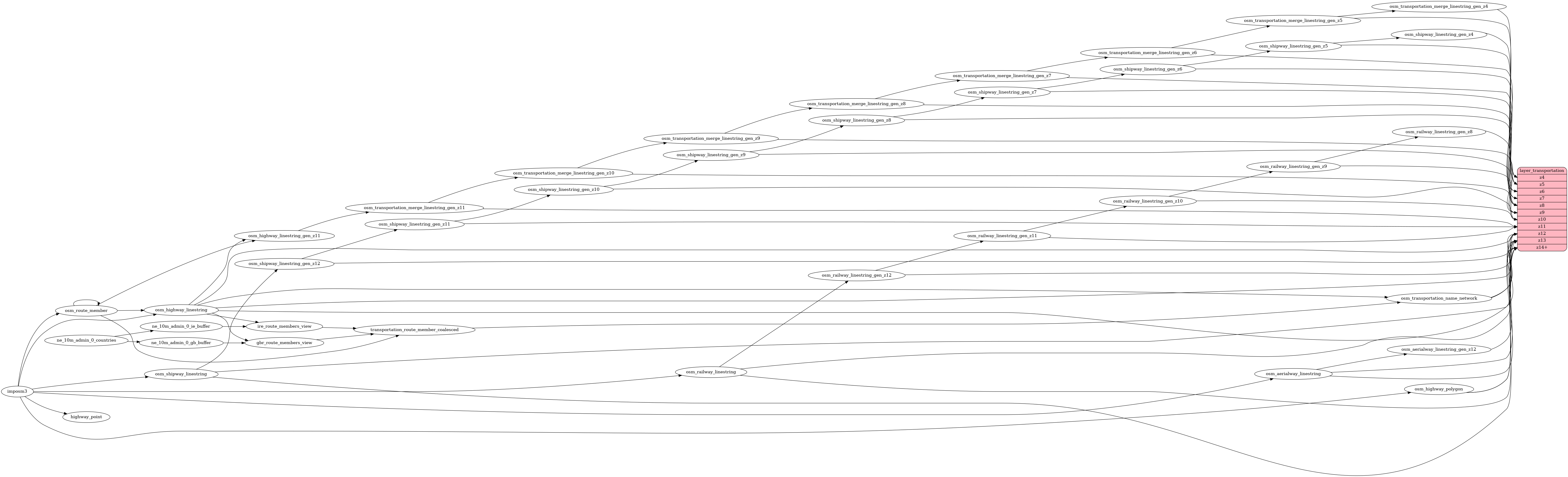
ETL diagram