kopia lustrzana https://github.com/openmaptiles/openmaptiles
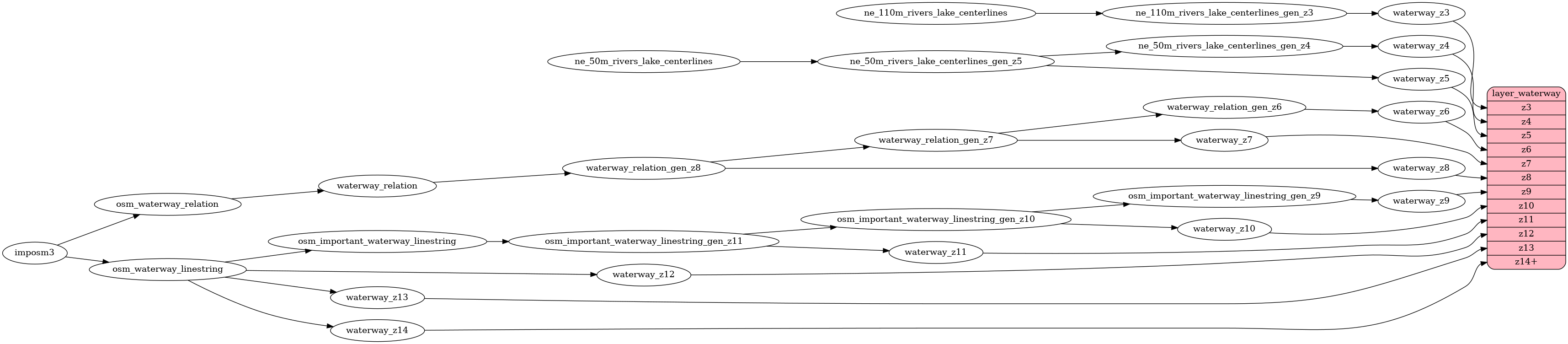
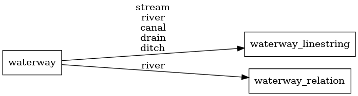
This PR is solving https://github.com/openmaptiles/openmaptiles/issues/406, partially also https://github.com/openmaptiles/openmaptiles/issues/320. It is changing source of data for zoomlevel 6 - 8 in `waterway` layer to OSM (relation `waterway = river`), this way it corresponds with `water` layer. Testing on Europe, z0 - z9 tiles increase size from 20.7 MB to 21.4 MB. We can discuss the level of generalization, but I think this size change is not critical. |
||
|---|---|---|
| .. | ||
| README.md | ||
| etl_diagram.png | ||
| mapping.yaml | ||
| mapping_diagram.png | ||
| update_important_waterway.sql | ||
| update_waterway_linestring.sql | ||
| waterway.sql | ||
| waterway.yaml | ||
README.md
waterway
Docs
Read the layer documentation at http://openmaptiles.org/schema#waterway
Mapping Diagram
ETL diagram