kopia lustrzana https://github.com/openmaptiles/openmaptiles
* OpenMapTiles style * Rename style snippets from layer_name.json to defaultstyle.json * Add README to icons dir. * Add README to icons dir. * Rename snippets to style.json * Fix spritezero - move icons to svg subdir * Move icons from style/icons/svg directly to style/icons Co-authored-by: Tomas Pohanka <TomPohys@gmail.com> |
||
|---|---|---|
| .. | ||
| README.md | ||
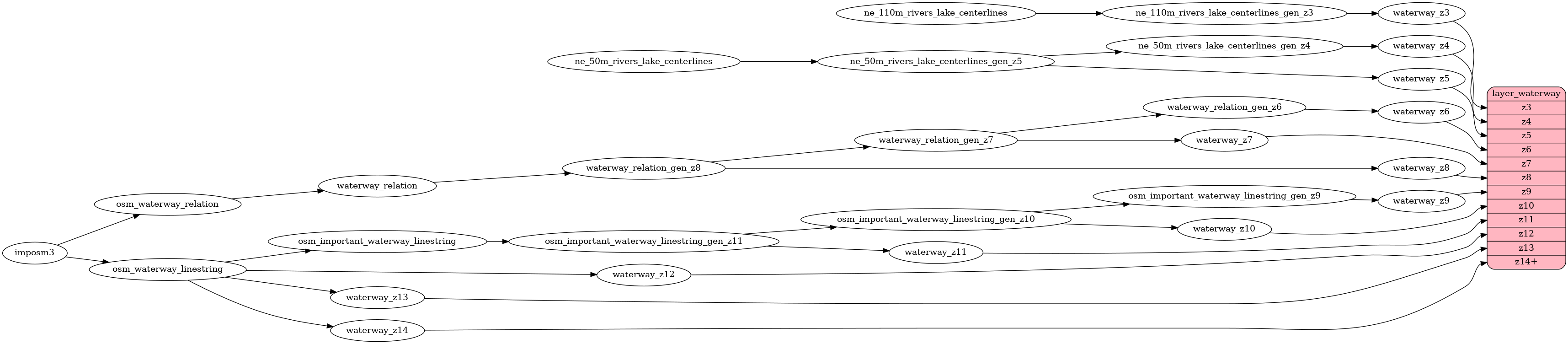
| etl_diagram.png | ||
| mapping.yaml | ||
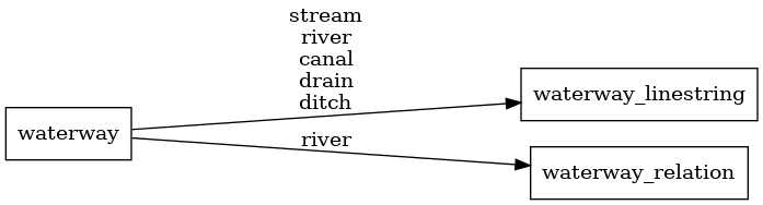
| mapping_diagram.png | ||
| style.json | ||
| update_important_waterway.sql | ||
| update_waterway_linestring.sql | ||
| waterway.sql | ||
| waterway.yaml | ||
README.md
waterway
Docs
Read the layer documentation at http://openmaptiles.org/schema#waterway
Mapping Diagram
ETL diagram