kopia lustrzana https://github.com/openmaptiles/openmaptiles
This PR allows queries to be parallelized on recent versions of Postgres. The `PARALLEL SAFE` modifier has been added to the layer functions and a PLPGSQL function to convert strings into number has been replaced. `PARALLEL SAFE` is a modifier for `CREATE FUNCTION` available since Postgres 9.6, so this change does not break current OpenMapTiles supported database version. More details about this topic [here](https://www.postgresql.org/docs/current/parallel-safety.html) and at the reference documentation for [`CREATE FUNCTION`](https://www.postgresql.org/docs/current/sql-createfunction.html). ### Testing procedure The procedure to test this was: * Imported `spain.pbf` in a clean environment * Dumped the OpenMapTiles database from the Postgres Docker image * Created a clean Postgres 12 database using the default Docker image * Installed `postgis` 3 from the default Debian package and `osml10n` 2.5.8 from the repository (`make`, etc.) * Restored the dump * Lowered the postgres planner parameters for triggering parallel plans: ```sql set parallel_setup_cost = 5; set parallel_tuple_cost = 0.005; ``` * Manually added the `PARALLEL SAFE` modifier to each function involved in layer queries (not on updates or inserting functions). * For each layer, run a testing query to confirm parallel workers were created, something like this: ```sql explain analyze select * from layer_aerodrome_label(tilebbox(8,128,95),10,null) union all select * from layer_aerodrome_label(tilebbox(8,128,97),10,null); ``` * After all the layers were processed and confirmed to start parallel executions, a more complete example was run. This example just retrieves the geometries for all the layers from the same tile but without using any MVT related function. <details><summary>Testing query</summary> ```sql -- Using the function layer_landuse explain analyze select geometry from layer_water(tilebbox(14,8020,6178),14) union all select geometry from layer_waterway(tilebbox(14,8020,6178),14) union all select geometry from layer_landcover(tilebbox(14,8020,6178),14) union all select geometry from layer_landuse(tilebbox(14,8020,6178),14) union all select geometry from layer_mountain_peak(tilebbox(14,8020,6178),14) union all select geometry from layer_park(tilebbox(14,8020,6178),14) union all select geometry from layer_boundary(tilebbox(14,8020,6178),14) union all select geometry from layer_aeroway(tilebbox(14,8020,6178),14) union all select geometry from layer_transportation(tilebbox(14,8020,6178),14) union all select geometry from layer_building(tilebbox(14,8020,6178),14) union all select geometry from layer_water_name(tilebbox(14,8020,6178),14) union all select geometry from layer_transportation_name(tilebbox(14,8020,6178),14) union all select geometry from layer_place(tilebbox(14,8020,6178),14) union all select geometry from layer_housenumber(tilebbox(14,8020,6178),14) union all select geometry from layer_poi(tilebbox(14,8020,6178),14) union all select geometry from layer_aerodrome_label(tilebbox(14,8020,6178),14); ``` </details> You can inspect the execution plan and results on [this page](https://explain.dalibo.com/plan/3z). Also [attaching](https://github.com/openmaptiles/openmaptiles/files/3951822/explain-tile-simple.tar.gz) the query and JSON output for future reference. The website gives a ton of details, but you may want to search for nodes mentioning `workers` or `parallel` like in this area referring to `osm_border` or `osm_aeroway_linestring` entities  ### Next steps Since the execution plan is not showing a parallel append at the top level, meaning it's not running each layer individually, I want to continue experimenting with parameters and queries to see if it's possible to even parallelize more the request. I will post my finding here, even no change in the code should happen. cc. @nyurik Co-authored-by: Yuri Astrakhan <yuriastrakhan@gmail.com> |
||
|---|---|---|
| .. | ||
| README.md | ||
| aeroway.yaml | ||
| etl_diagram.png | ||
| layer.sql | ||
| mapping.yaml | ||
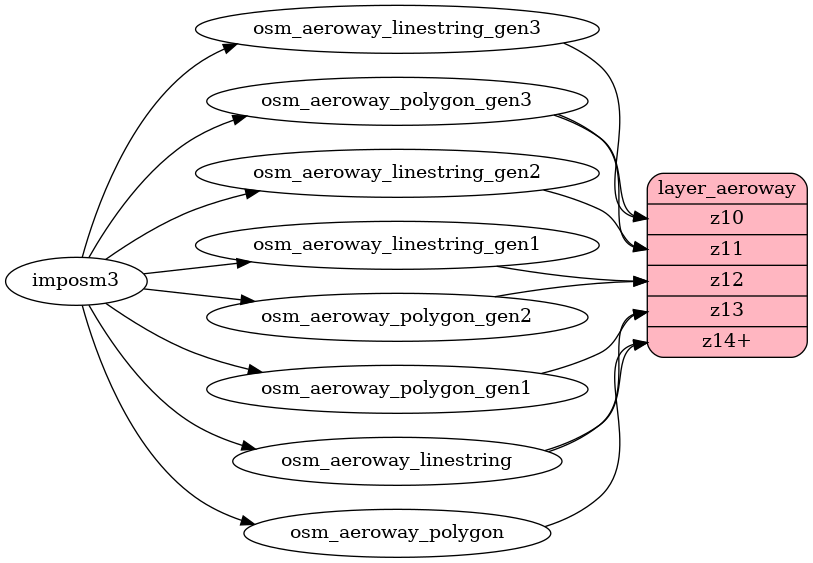
| mapping_diagram.png | ||
README.md
aeroway
Docs
Read the layer documentation at http://openmaptiles.org/schema#aeroway
Mapping Diagram
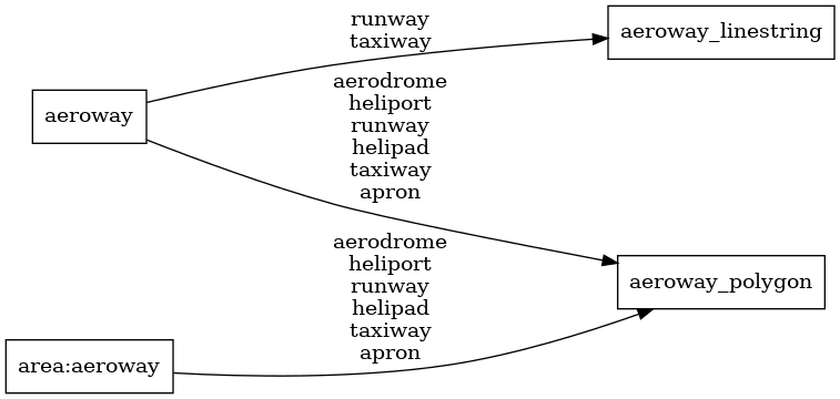
ETL diagram