kopia lustrzana https://github.com/openmaptiles/openmaptiles
Adds a new class value for the place layer, `borough`, and adds it to the OSM style with the same appearance as hamlets and suburbs. |
||
|---|---|---|
| .. | ||
| README.md | ||
| capital.sql | ||
| city.sql | ||
| etl_diagram.png | ||
| island_rank.sql | ||
| mapping.yaml | ||
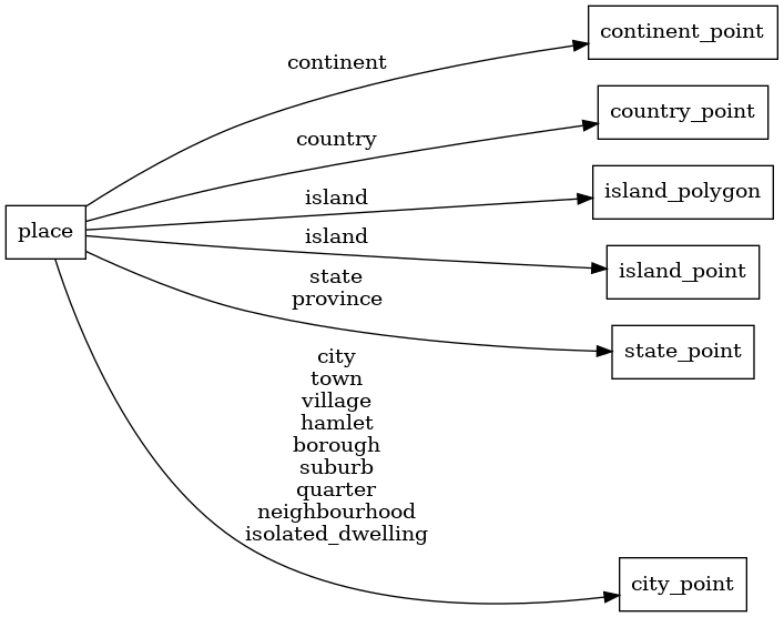
| mapping_diagram.png | ||
| place.sql | ||
| place.yaml | ||
| style.json | ||
| types.sql | ||
| update_city_point.sql | ||
| update_continent_point.sql | ||
| update_country_point.sql | ||
| update_island_point.sql | ||
| update_island_polygon.sql | ||
| update_state_point.sql | ||
README.md
place
Docs
Read the layer documentation at http://openmaptiles.org/schema#place
Mapping Diagram
ETL diagram
