kopia lustrzana https://github.com/openmaptiles/openmaptiles
Update style snippets with the latest changes. |
||
|---|---|---|
| .. | ||
| README.md | ||
| boundary.sql | ||
| boundary.yaml | ||
| boundary_name.sql | ||
| etl_diagram.png | ||
| mapping.yaml | ||
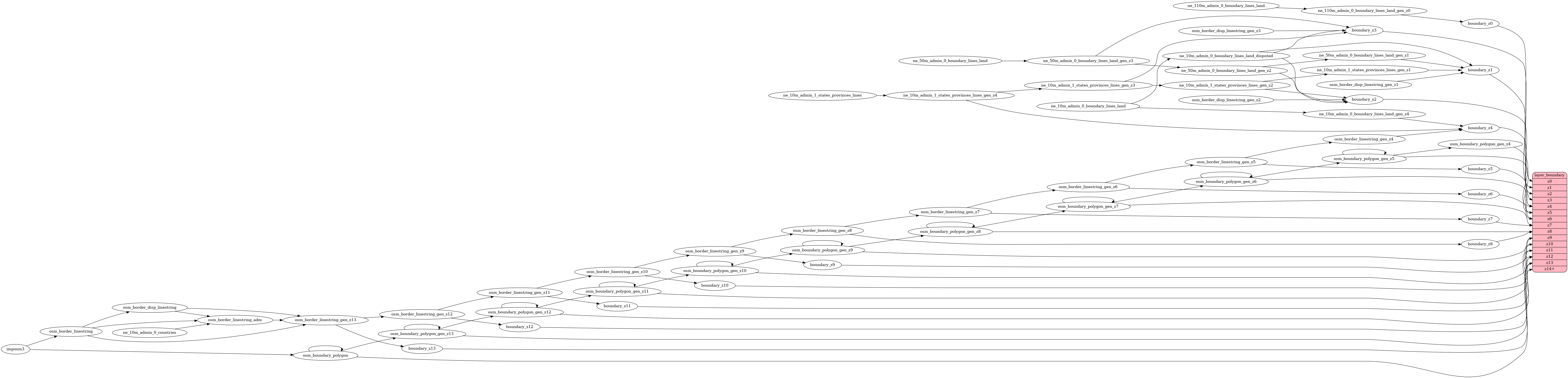
| mapping_diagram.png | ||
| style.json | ||
| update_boundary_polygon.sql | ||